

Soprasasso Caves: A Slice of the Moon in the Reno Valley
Soprasasso Caves: how to get there, the circular trail from Riola, difficulty, elevation gain and practical tips for a lunar-like hike near Bologna.
VIAGGI | TRAVELS
Rebecca P. & Raffaele F.
7/25/20268 min read
Soprasasso Caves: Walking on the Moon Without Leaving the Bologna Apennines
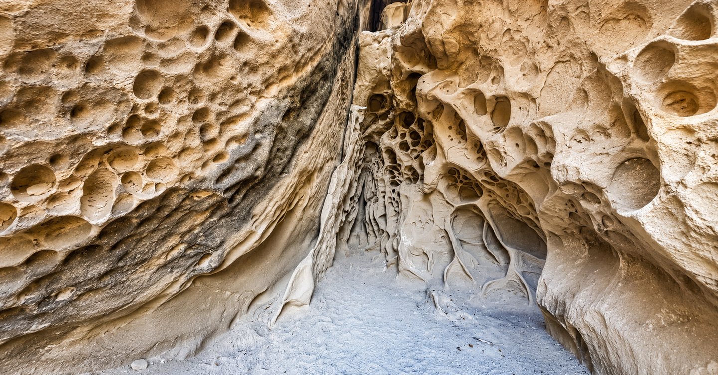
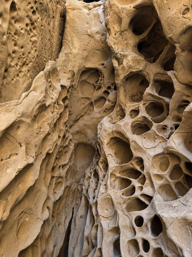
At first glance, you could be forgiven for wondering whether someone had taken a piece of the Moon and casually dropped it among the forests of the Bologna Apennines. That is the magic of the Soprasasso Caves: after an uphill walk, a few stretches through the greenery and a healthy dose of effort, they suddenly appear, with their pockmarked walls, rounded niches and shapes reminiscent of honeycombs, seabeds or science-fiction landscapes.
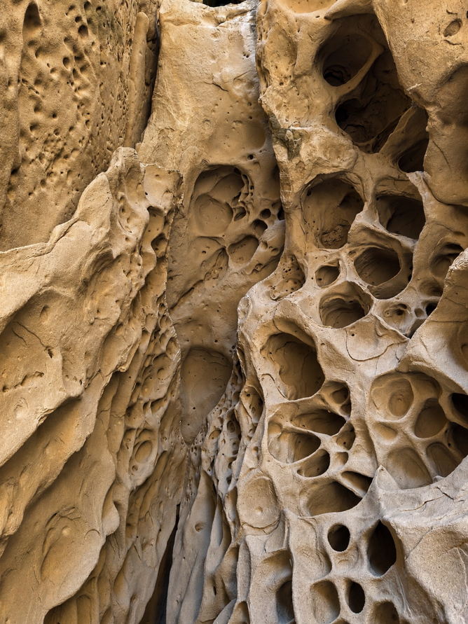
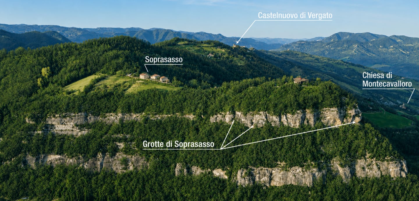
The caves lie near Riola, a village in the municipality of Vergato, around 50 kilometres from Bologna. They are not caves in the traditional sense, like those carved by water through limestone. Instead, they are cracks and natural shelters opening into a vast sandstone wall, slowly shaped by the weathering of the rock. The rounded hollows covering the walls are known as tafoni, and they are the area’s most distinctive feature.
The rock dates back millions of years, to a time when this area lay beneath a deep marine basin. Today, the result is a decidedly unusual setting: yellow, rough and filled with shadows and tiny recesses. In places, it really does feel as though you are looking at the surface of another planet, although all you need to do is turn around to find the Reno Valley, the forests and the peaks of the Apennines spread out before you.
The hike to the Soprasasso Caves is one of those walks that works so well because it offers a little bit of everything. There are woodland paths, panoramic views, a few sections requiring extra care and, above all, a destination that makes the climb entirely worthwhile. This is not one of those hikes where you walk for hours waiting for something interesting to appear: the landscape changes frequently, and the closer you get to the rocks, the more your curiosity grows.
Practical Information, Difficulty and What to Pack
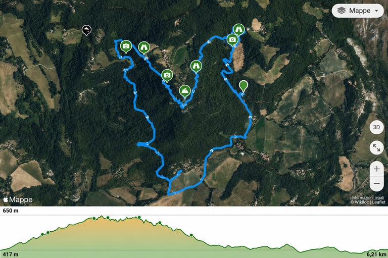
The complete circular hike to the Soprasasso Caves from Riola is approximately 10 kilometres long. The exact distance may vary slightly depending on the route followed, any diversions taken and the option chosen to complete the loop.
The total elevation gain is around 550 metres, while the walking time is approximately 3 hours 15 minutes to 4 hours. You will also need to allow for stops, and there are likely to be plenty of them here: taking photographs, having lunch, exploring the cavities and pausing to enjoy the views. To experience the route without constantly checking the time, it is best to set aside at least half a day.
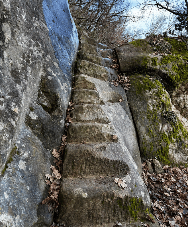
The route is graded E according to the Italian hiking classification system. This means it is suitable for hikers who are accustomed to walking on trails, but it should not be mistaken for an easy tourist stroll. The traverse beneath the rock walls includes narrow and steep sections, while reaching the Grotta Buia involves more challenging terrain and is only recommended for those who feel confident on rough, exposed ground. The return route also includes some steep descents and a short staircase carved into the rock.
Hiking boots or shoes with good grip are essential. Your backpack should contain plenty of water, something to eat, a lightweight jacket, a torch if you plan to explore the interior of the Grotta Buia, and a GPS route downloaded for offline use. There are signs along the trail, but in the woods it is always wise to have an additional point of reference.
The best time to enjoy this hike in the Bologna Apennines is from spring to autumn, avoiding the hottest hours of the day during summer. After heavy rainfall, the ground can become muddy and the slopes leading up to the rocks extremely slippery. The trail remains fascinating in winter, when the more open woodland reveals wider views, but frost, snow and wet leaves can make the route more difficult. Before setting off, it is always worth checking the weather forecast and the latest trail conditions.
How to Reach the Soprasasso Caves from Bologna
Our recommended starting point for the Soprasasso Caves is Riola railway station, which can be reached by trains running along the Bologna–Porretta Terme line. Within just a few minutes of stepping off the train, you can have your hiking boots on and be on the trail. It is a convenient and sustainable option, and ideal for anyone who would rather not drive back with tired legs. Signs for the circular route can be found immediately outside the station.
Those arriving by car can follow the SS64 Porrettana road towards Sasso Marconi, Marzabotto and Vergato, continuing onwards to Riola. There are places to leave your car near the station and begin the walk. Before setting off, however, it is advisable to check the actual availability of parking spaces and avoid leaving your vehicle beside private entrances or along narrow roads.
From the station, located at an altitude of around 251 metres, head towards the main road and pass beneath the Porrettana viaduct. A little further on, cross the road and turn onto Via della Quiete, where you will find signs for CAI Trail 162 and the Anello del Soprasasso circular route. The street’s name, which translates as “Road of Tranquillity”, sounds promising. The initial gradient, slightly less so.
A shorter version of the hike is also possible. Many websites, including the official Emilia-Romagna regional tourism website, suggest driving close to the final section of the trail, to the point marked on Google Maps as “Parcheggio per le Grotte di Soprasasso”.
This is not a proper car park: vehicles are left in a small lay-by at the side of the road, with space for no more than three or four cars. From here, you can immediately join the uphill trail by following the signs for the “Grotte di Soprasasso”.
The Circular Route from Riola: Forests, Meadows and Tiny Villages
Beyond the last houses, the tarmac gradually gives way to an unpaved track. The route climbs towards Mondarca, enters the forest and continues along Trail 162. Some sections are fairly steep, particularly near the beginning, but the route alternates between climbs, short descents and gentler traverses. Whenever the trees open up, you are rewarded with views of Montovolo and the pointed outline of Monte Vigese.
On reaching the hamlet of La Serra, at just over 400 metres above sea level, the trail passes close to the buildings of a working farm before continuing along a ridge. Shortly afterwards, you reach the point where the two branches of the circular route separate. Taking the option that climbs towards Torziano, the path continues through woodland and clearings until it reaches the houses of the tiny hamlet, at an altitude of around 550 metres.
This is where the atmosphere begins to change. The trail narrows, the ground becomes more uneven and the rock walls draw closer. A series of bends leads uphill through the forest to a ledge: a kind of natural terrace running between two sandstone cliffs.
This is not a mountaineering section, but it does require a steady footing. In places, the path is narrow and the slope drops steeply towards the valley below. Anyone with a strong fear of heights may find this section uncomfortable.
There is no need to rush. Slow down, watch where you place your feet and leave your phone in your backpack for at least a few minutes. The first shapes carved into the sandstone appear almost without warning: small holes, rippled surfaces and increasingly deep niches. They are the first sign that the most eagerly awaited part of the route is finally close.
The Caves, the Tafoni and That Strange Feeling of Being on the Moon
The first and most challenging cavity to reach is the Grotta Buia, or “Dark Cave”. Its entrance lies just above the main trail and involves climbing a short, steep and sometimes unstable earthy slope. This section is considered more difficult than the rest of the route and can easily be skipped. You do not need to enter every cavity to appreciate the beauty of Soprasasso.
Anyone who decides to climb up should use both hands, avoid attempting the section when the ground is wet and carry a torch. The Grotta Buia extends several metres into the rock face and, as its name suggests, the natural light disappears fairly quickly. The interior is incredibly atmospheric.
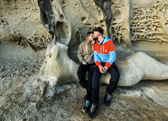
Continuing along the wall, you reach the Grotta dei Piatti, probably the most recognisable and photographed spot on the entire hike. It is a large, shallow, triangular recess whose walls are covered in smooth circular hollows. Some look like bowls, while others resemble tiny craters. This is where the cave gets its name, and where the inevitable comparison with the Moon comes from.
Light enters from the side, reflects off the sandstone and changes the colour of the wall within a matter of minutes: pale yellow, ochre and almost orange. When the sun slips behind the clouds, the cavities appear darker and deeper. When sunlight returns to the rock, the entire ceiling seems to light up.
A short climb leads to the southern spur of Soprasasso, at an altitude of around 660 metres. From here, a broad view opens across the Reno Valley and, on clear days, you may be able to see as far as the Corno alle Scale massif.
On one side lies the lunar landscape of the rocks; on the other, the green Apennines descend towards the valley floor. Two almost incompatible scenes, separated by only a few steps.
The Soprasasso Caves include three main cavities: the Grotta Buia, the Grotta dei Piatti and the Grotta di Soprasasso. The area is recognised as a geosite of local importance and lies within a particularly delicate natural environment.
The sandstone formations are not indestructible. Visitors should therefore avoid climbing on the tafoni, removing fragments or carving into the rock.
The Return to Riola and the Temptation to Stay a Little Longer
After following the base of the walls, the path crosses a staircase carved into the rock and climbs above the cliff. The ground remains steep for a short distance before the descent begins.
The trail re-enters the forest, reaches a minor road and passes close to Costonzo, where there is an ancient tower house that is now privately owned and closed to visitors.
A little further on, the route returns to the junction passed on the outward walk, near La Serra. From here, retrace the trail towards Mondarca and Riola.
To make a full day of it, you can also visit the nearby Labante Caves, with their landscape shaped by flowing water.
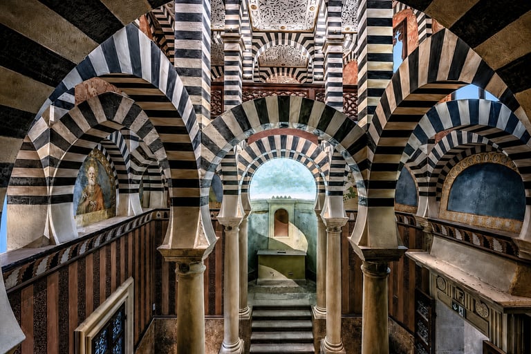
Alternatively, you could explore the nearby Rocchetta Mattei, although admission normally needs to be booked in advance. We recommend the ticket with a guided tour available through GetYourGuide. Download the app and enter the code ZAINOINDUE5 to receive a 5% discount on this booking and on all other available experiences.
Your Next Escape from Earth Starts Here!
Did this hike spark your curiosity? Save the article and share it with the person you would most like to take on the trail.
For new itineraries, weekend inspiration and unusual places to discover, subscribe to our newsletter.
Follow us as we explore trails, villages and lesser-known corners of Italy. You can also find us on Instagram, Facebook and TikTok.
Your next otherworldly landscape may be much closer than you think.
Let us know what you think
Leave a comment
Social Link
Follow us on our social channels
Instagram, Facebook e TikTok
ContaCTS
Newsletter
© Copyright 2026 - Zaino in Due